|
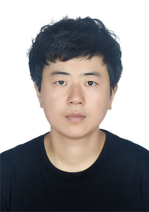
ZhangyindanDegree: Ph.D. Email: ydzhang@nwnu.edu.cn Office Location: Tel: Address: The inauguration: College of Geography and Environmental Science depart: Major: Discipline: Graduate School Lanzhou University |
|
|
|
10 Access |
Related to the teacher |
About
EducationPh.D. (2020), Cartography and Geographic Information System, Lanzhou University. Joint Ph.D. (2018), Geospatial Analytics, North Carolina State University and University of North Carolina at Charlotte. M.S. (2010), Softare Engineering, Huazhong University of Science and Technology. Work ExperienceSocial PositionResearch FieldI am a RS & GIS algorithmist and apply remote sensing (e.g., lidar and high-resolution optical data), multi-source data fusion; artificial intelligence (e.g., deep learning), and geospatial big data mining and understanding to understand complex urban landscapes and monitor the change of urban environment to achieve a sustainable and equitable future. Open CourseResearch Projectv 2023 - 2026: Natural Science Foundation of Gansul, China “Research on remote sensing monitoring method of pollutants entering rivers based on deep learningt” (PI) v 2023 - 2024: Science and Technology Planning Project of Gansu Province, China “Research on construction technology of provincial and municipal integrated three-dimensional spatial and temporal database” (PI) v 2021 - 2022: Science and Technology Planning Project of Jiangxi Province, China “Xunwu Dongjiang Source Basin River Outfall Investigation Project” (PI) ThesisWritingsn PUBLICATIONS IN RECENT 5 YEARS (* CORRESPONDING AUTHOR) [1] Yindan Zhang, Gang Chen*, Jelena Vukomanovic, et al. Recurrent Shadow Attention Model (RSAM) for shadow removal in high-resolution urban land-cover mapping. Remote Sensing of Environment, 2020, 247: 111945. [2] Yindan Zhang, Gang Chen*, Soe W. Myint, et al. UrbanWatch: A 1-meter resolution land cover and land use database for 22 major cities in the United States, Remote Sensing of Environment, 2022, 278: 113106. [3] Yong Liu*, Yindan Zhang, Zhe Huang, et al. Segmentation optimization via recognition of the PSE-NSR-ED2 patterns along with the scale parameter in object-based image analysis. GEOBIA2016. DOI:10.3990/2.452. [4] Jing Li, Yong Liu*, Yindan Zhang, etc al. Cascaded Attention DenseUNet (CADUNet) for Road Extraction from Very-High-Resolution Images. ISPRS International Journal of Geo-Information, 2021, 10(5) : 329. [5] Cheng Li, Ge Sun*, Erika Cohen, Yindan Zhang, et al. Modeling the impacts of urbanization on watershed-scale gross primary productivity and tradeoff with water yield across the conterminous United States. Journal of Hydrology, 2020, 583: 124581. [6] Cheng Li, Ge Sun*, Peter V. Caldwell, Erika Cohen, Yuan Fang,Yindan Zhang, et al. Impacts of urbanization on watershed water balances across the conterminous United States. Water Resources Research, 2020. 56(7): e2019WR026574. v National journals (in Chinese with English abstracts): [1] Yindan Zhang, Miaomiao Wang, Haixia Lu, Yong Liu*. Comparing supervised and unsupervised segmentation evaluation methods for extracting specific land cover from high-resolution remote sensing imagery. Journal of Geo-information Science, 2019. 21(9): 1430-1443. [2] Haixia Lu, Yong Liu*, Yindan Zhang, et al. An approach for extracting forest in a wide area and its generalization performance: integrating machine learning and geographic object based image analysis. Journal of Lanzhou University (Natural Sciences), 2020. 56(3): 363 - 370. [3] Yue Jiang, Din ul Shaker, Yong Liu*, Yindan Zhang, et al. Backdating analysis of remote sensing image changes for geographic objects based on an integrated multi-classifier. Journalof Lanzhou University (Natural Sciences), 2020. 56(5): 224- 261. [4] Jin Xing, Jianxi Hou, Yong Liu*, Yindan Zhang, et al. Strategy of remote sensing thematic mapping for adaptively balanced time phase in a large area. Journal of Lanzhou University (Natural Sciences), 2021. 57(4): 473 - 482. [5] Mengyu Qin, Yong Liu*, Yindan Zhang, et al. Extraction of urban buildings from high-resolution remote sensing images based on improved U-Net model. Journal of Lanzhou University (Natural Sciences), 2022. 58(2): 224- 261. WritingsPatentv National patent for invention (in Chinese): [1] Yindan Zhang, Yong Liu, Miaomiao Wang, Zhe Huang. 2019. Method for automatically selecting remote sensing image segmentation parameters based on regional discrepancy evaluation. (2016110056873). Honor RewardSoftware achievement |